Map Lies & Mistakes: Paper Towns & Fake Roads 🧐
Don't trust every direction: some aren't real (🧐Map Facts Series)
Hi! If you’re new here, this is Map Nerd. We explore amazing places and cool things on the world map, usually with a video story + quick digestible info. If you enjoy it, subscribe and you can explore with us!
Map Lies & Mistakes:
paper towns, fake roads, phantom places
Have you ever tried to turn on a road that wasn’t there? Don’t be ashamed, the map duped you. Despite our unshakable trust in iphone directions, all maps have errors. They’re at best, unfortunate mistakes, and at worst, they’re purposeful lies. They’re also really common, just so small or irrelevant that you never notice, bc all maps, even the google variety, are put together by real human people.
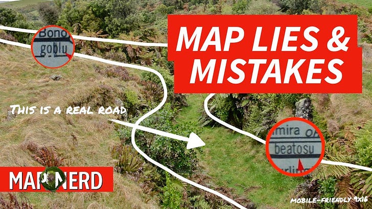
There are some legendary blunders in mapmaking history: The funnest being the 1979 edition of Michigan’s highway map, which includes the towns of “goblu” and “beatosu” in Ohio (apparently the editors didn’t notice, or they did, but hey, go blue).
Google Maps showed the non-existent town of Argleton, England until 2010. Could’ve been an honest mistake or on purpose: map nerds pointed out that if you rearrange the name, it spells Not Real with G leftover for Google.
Some errors aren’t errors at all. New Zealand has about 30,000 miles of real roads that don’t actually exist. They’re called Unformed Legal Roads or Paper Roads. They’re official roads planned and plotted on maps, but they were never built. So technically you could drive right through there, if your car can get past the forest. There are paper roads like that all over (bc planning never goes as planned). You can probably google paper road with your home area and find one.
But my favorite reason for map errors is the simplest one: maps are subjective. That may sound weird because the location of your house isn’t really up for interpretation, but think about it: what you can put on a map is infinite: an ocean, sea, lake, river, stream, even a rock. But mapmakers decide what they think they should put on there, largely based on each maps’ purpose and scale. On all maps, even google, someone is deciding what you see.
That leads to fun questions like how do we know the true length of a coastline… doesn’t it really depend on how much we want to show?


