Japan Added 7,200 Islands This Year 🗞️
Which begs the question: what counts as an island?
Hi! If you’re new here, this is Map Nerd. We explore amazing places and cool things on the world map, usually with a video story + quick digestible info. If you enjoy it, subscribe and you can explore with us!
In This Post:
This Weeks Video: Japan Adds 7,273 “New” Islands
What’s An Island Anyway?
Isle, Key, Skerry, Ait,… Oh My!
Countries with the Most Islands
Japan Added 7,200 Islands This Year.
Which begs the question: what counts as an island?
This is a fun one…
Japan is about to add 7,200 more islands to its nation.
Japan has had 6,852 islands since 1987. That’s the official number kids are taught in school. Back then, the coast guard did a survey using paper maps. Last year, the government voted to recount their islands using much more precise digital tools, and the result is the addition of 7,273 “new-ish” islands (subject to a final review).
It won’t change Japan’s territory, just its textbooks.


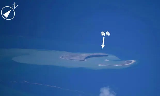
The brunt of the additions aren’t actually new, they were just overlooked before because it relied on people manually poring over paper maps. But, there are some actually new islands that weren’t around in 1987, because Japan’s volcanoes have spewed out at least a handful in the last 30 years.


Obviously this all depends on what they define as an island. In this case, Japan mostly followed the UN Law of the Sea, which defines an island this way (as any “natural land surrounded by water which is above water at high tide”). But, they did give themselves limits: they apparently did not count islands in lakes or rivers, and only counted circumferences above 100 meters (this point is hard to 100% confirm; Many media sources claim that one of the reasons for the recount is because Japan did not count river/lake islands in 1987, but they neglect to state that this was changed for the recount, and a few local Japanese sources state specifically that islands in lakes/rivers “were not counted” for the updated survey).
Different countries count their islands differently, so any lists of who has the most are unreliable. For example, the southernmost island in Japan’s current count is considered a rock by Taiwan. Sweden usually claims the title of country with most islands. They count more than 267,000, but that includes basically anything surrounded by water, natural or not.
Some places like to split it up: what doesn’t count as an island could be an isle, key/cay/caye, skerry, or ait/eyote (we get more into what the heck those are down below!)
Any which way, it’s clear what country has the least islands…
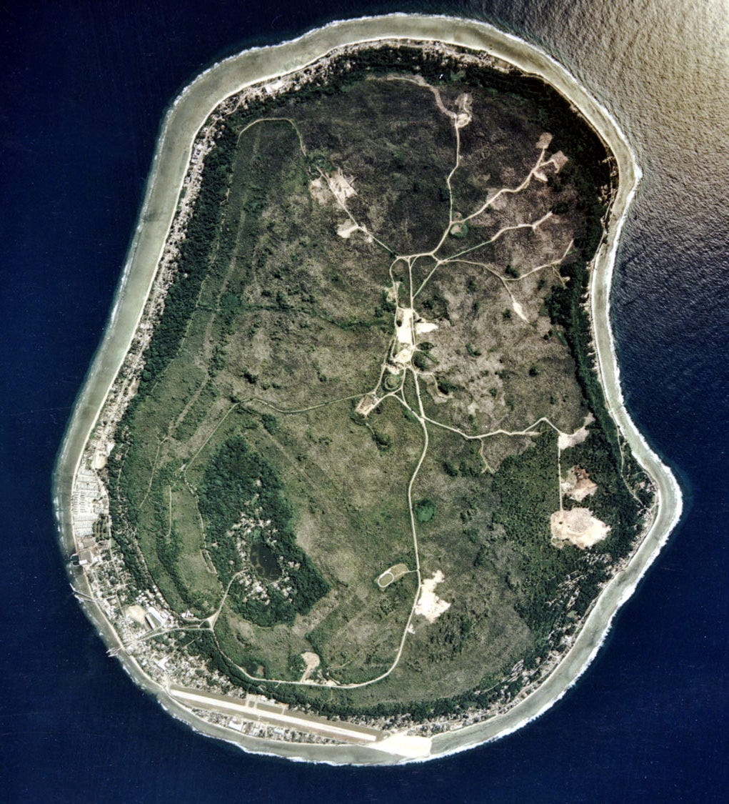
That would be Nauru, with one, which is its country. 🇳🇷
What’s An Island Anyway?
Aren’t we all surrounded by water…?
Okay, so let’s get into this definition of an island thing. Like anything, what is and isn’t an island is up for debate, depends entirely on how you define it, and is, of course, different all over the world. (but isn’t that what makes it so fun?!)
The standard baseline definition of ISLAND is almost always “land that is surrounded by water.” You’ll see some variation of that phrasing in most dictionaries. The majority of these dictionaries will also include something to the effect of “but is not a continent.” That differentiation is important to shut down the crowd that screams “but isn’t everything surrounded by water?!”
From there, definitions start to diverge, from country to country and organization to organization. The standard most places start with is the definition memorialized at the United Nations Convention on Law of The Sea (“UNCLOS”). UNCLOS set out guidelines for international understanding on how the territory of the world’s oceans should be controlled and administered among and between nations. As part of this, it defines an island as “a naturally formed area of land, surrounded by water, which is above water at high tide.”
So UNCLOS adds two key ingredients to the definition of an island: 1) it must be naturally formed, and 2) it is above water at high tide. That eliminates artificial islands like harbor breakwaters & the Palm Jumeriah, and sandbars.
After that, filling out the rest of the definition appears to be fair game for others to decide. Most countries and organizations put a size minimum, or some capacity for it to be habitable (ie not just a big rock), or a geological underpinning that differentiates it from the mainland continent.
Since most nations now use sophisticated digital mapping/geospatial tools, some rely on software definitions. For example, Sweden’s current definition includes “land areas surrounded by water, according to Lantmäteriet's (the national land survey office) real estate map, map layers "MV Outer layers with water (lakes and large watercourses). The water map of Lantmäteriet shows water in the scale 1:10 000 within the borders of Sweden. "The hole" in the water map has formed the islands.”
Link to Statistics Sweden: “3% of Sweden’s land area consists of islands”
It all gets more subjective beyond that, and you really have to dig into each particular organization’s guidelines to understand exactly what they mean by “ISLAND.”
Isle, Key, Skerry, Ait… Oh My!
Many countries have different words for different types of islands. It’s understandable to want to split them up by type. Unfortunately, words for these “sub-categories” are often mixed up, mashed up, and poorly defined. So, if people use them, they often use them interchangeably. Regardless, here they are so you can pepper them in at your next dinner party and leave your guests wowed at your superior geographical and linguistic knowledge!:
Isle: can be used for a small island, but considering 200 square mile Isle of Man, can be used for big ones too :)
Islet: Theoretically smaller than an isle. Usually very tiny, probably uninhabited.
Cay / Caye / Key: Cays are low sandy islands, usually in a chain, formed from reef/coral. See: The Florida Keys.
Skerry: A Scottish/British term, a skerry is a rocky outcropping. It doesn’t necessarily have to be tiny though.
Ait / Eyot: pronounced “ate,” also a British term. Refers to a small island in the middle of a river.
Holm: another small inland island, in a river or a lake or beside a larger island. Another chiefly British term, with Norse origins.
Atoll: this one has the most distinct and widely accepted definition on this list: an atoll is a ring-shaped island with lagoon in the middle, usually formed by reef/coral, primarily in the South Pacific.
Haven: a port, harbor, or other away-from-the-open-ocean shelter, including islands that serve that purpose.
Bar: like “sandbar,” these are low areas of sand/sediment that pop up out of the water, but also may get washed away.
Countries with the Most Islands
As stated previously, lists of countries with most islands are debatable and unreliable. This is mainly because everyone counts/defines their islands differently. Most “credible” lists put Scandinavian countries at the top, which makes sense since they have very large coastlines and are geologically pockmarked with fjords, bays, and rivers.
Wikipedia puts Sweden at the front, but It seems to me that Norway could count its way to the top just as easily, and perhaps so could Finland.
Canada shares similar geological terrain to Scandinavia, but Statistics Canada says the country doesn’t have nearly as many as Sweden: 52,455 islands (as of 2018). I am guessing their definition is more limiting than those of the Scandinavian countries (i’ve been digging for the definition they use, but as yet cannot find - will update here if/when do!).
Places that are known for their numerous islands, like Greece and the Philippines, pale in comparison to the Scandinavian countries and Canada. I would guess some has to do with definitions, but mostly that the geology/geography of the northern hemisphere arctic terrain just makes for way more island bits than the Mediterranean or tropical South Pacific.
I pasted below Wikipedia’s current Top 15 (as of 3/1/2023, also linked at bottom for full list). You will note the numerous notes/exceptions/caveats; that’s all because everyone uses a different definition!…


There is a national park in Canada called the 1,000 islands (actually over 1,800 fresh water islands), but the definition they use is that an island must support at least one living tree and be larger than 0.093 m². Anything else and it’s just a rock. Not sure if this rule is applied across the country or just for the St. Lawrence river.